Fort Mandan State Historic Site is temporarily closed for maintenance until further notice.

Situated just off Interstate 29, Exit 215, in Pembina, ND.
Summer Hours (May 1-September 30)
Monday-Saturday, 9 a.m.-5 p.m.
Sunday, 1-5 p.m.
Winter Hours (October 1-April 30)
Tuesday-Saturday, 9 a.m.-5 p.m.
Closed New Year’s Day, Easter Sunday, Thanksgiving Day, and Christmas Day.
Features permanent & temporary exhibits
Travel information
Museum store
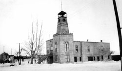
Observation tower
Meeting room/facility rental
Modern facilities
On-site parking
ADA-accessible
The Pembina State Museum features a modern meeting room with an adjacent kitchen that is available to rent. After hours use of the lobby area and back lawn are also available for groups. Contact the museum at least two weeks in advance of the gathering for reservations.
Free admission for the exhibits and museum store.
Observation tower:
$2.00 for ages 16+
$.50 for ages 6-15
Free for ages 5 and under
Introduction to Pembina, North Dakota
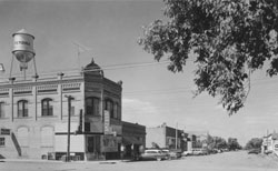 Situated at the extreme northeastern corner of North Dakota, Pembina occupies a unique place in the state’s heritage. The region is noted for a number of “firsts” in North Dakota’s recorded history, including the first European settlement, first organized church, first school, first post office, first border/customs house, and first homestead within present state borders.
Throughout much of its history, the Pembina region has been remote and sparsely inhabited. Native people occupied the area on a seasonal basis, utilizing resources such as the high bush cranberry for which Pembina is reputed to have been named.
As transportation methods developed, Pembina became more accessible and more populated and well-traveled.
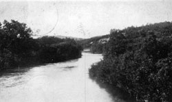
Pembina is located at the confluence of the Pembina and Red rivers. The Red River of the North originates south of Pembina, near the South Dakota border, and flows north into Canada. The river serves as a natural boundary between North Dakota and Minnesota.
 Pembina’s recorded history is closely tied with Canada. Prehistorically, Pembina’s earliest residents were nomadic people who traveled in and out of the region from all directions. Early explorers and traders came up the Red River from Canada in the late 1700s, and established fur trade posts. Many of Pembina’s earliest permanent settlers came from Canada or were involved with Canadian-American trade operations.
After the Treaty of Ghent established the 49th parallel as the boundary between Canada and the United States, Pembina became a gateway of commerce between the two countries in the 1800s.
Today Pembina continues to serve as a port of entry between Canada and North Dakota.
North Dakota during the Cretaceous Period
In the Pembina area there are fossil remains and deposits from the Cretaceous Period. During this time, North Dakota was covered by warm, subtropical seas. Many types of marine life inhabited North Dakota during the Cretaceous. Sharks, bony fish, squid, and giant marine reptiles lived in the water. Snails, clams, sea urchins, and crabs lived along the shorelines. Enormous, flightless seabirds nested on the water’s edge.
The Ice Age
For more than 500 million years, North Dakota’s climate was very warm. About 2.5 million years ago, the climate became cooler and cooler, leading into the Ice Age, when much of the earth’s water was frozen into glaciers. The Ice Age consisted of several 100,000-year cycles of cooling and heating. During cool times, glaciers formed and moved south into North America (and Europe and Asia). During warm cycles, the glaciers melted and retreated to the north.
As glaciers melted at the end of the Ice Age 10,000 to 11,000 years ago, huge lakes were created. Lake Agassiz was the largest glacial lake, covering Pembina and parts of North Dakota, South Dakota, Minnesota, Manitoba, Saskatchewan, and Ontario. Fluctuating in size and shape over an approximately 2000-year period, glacial Lake Agassiz covered 350,000 square miles at its greatest peak.
Pembina is part of the area called the Red River Valley. Technically, this region is a lake bed, not a valley. The Red River cuts a slow, winding path through the flat, northward-sloping plain of former Lake Agassiz’s eastern and western shores.
The Red River Valley is known as the “Breadbasket of the World.” The rich soil of the region was deposited by Lake Agassiz.
Address:
805 State Highway 59,
Pembina, ND 58271
Get Directions
Summer Hours (May 1-September 30)
Monday-Saturday, 9 a.m.-5 p.m.
Sunday, 1-5 p.m.
Winter Hours (October 1-April 30)
Tuesday-Saturday, 9 a.m.-5 p.m.
Closed New Year’s Day, Easter Sunday, Thanksgiving Day, and Christmas Day.
Contact Pembina State Museum:
phone: 701.825.6840
email: shspembina@nd.gov
Contact SHSND:
phone: 701.328.2666
email: history@nd.gov